A representative from Manaslu Tours will welcome you upon your arrival in Kathmandu and drive you to your hotel. To start your journey on a high note, we will host a welcome dinner in the evening featuring authentic Nepalese cuisine and a warm welcome drink.
- SWOYAMBHUNATH , also referred to as the monkey temple, is accessible by a steep set of steps and offers stunning views of Kathmandu.
- BOUDHANATH STUPA has many traditional gompas hung with strings of multi-colored prayer flags; it attracts many Sherpas and Tibetans for the circumambulations of the stupa (koras).
- PASHUPATINATH is a Hindu temple with burning ghats on the banks of the Bagmati River.
- KATHMANDU DURBAR SQUARE, which is one of the old capitals of the Kathmandu valley, has a blend of Hindu and Buddhist temples
After an early departure by private bus to reach Barpak, we follow the Daraudi Khola River, passing through terraced rice fields. A long climb on a track leads us to Barpak, the main village of the Gurung ethnic group, located on a small plateau overlooking the valley. In front of us stands the snowy face of the Buddha Himal (6672m).
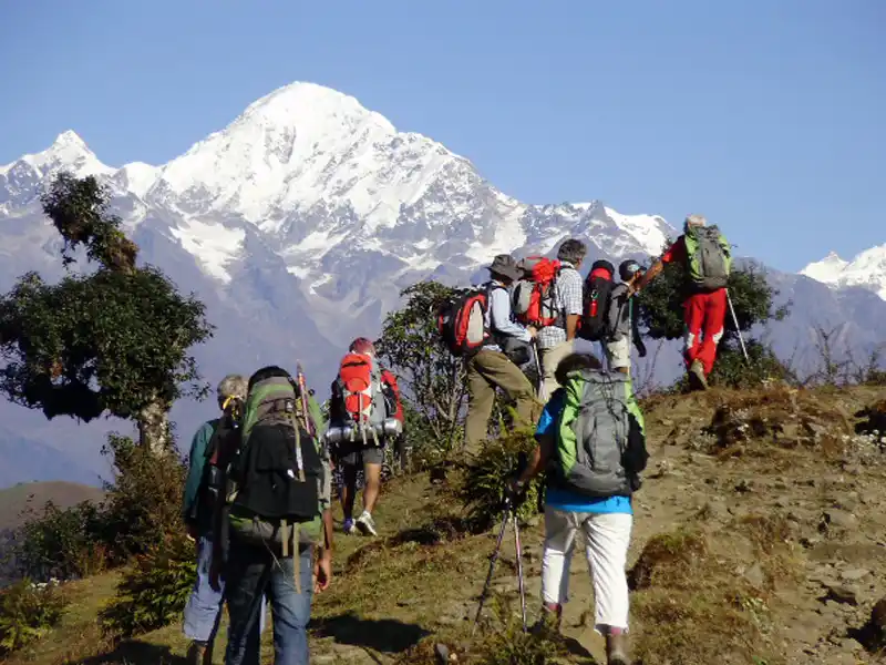
The first day of trekking is a steep climb through a beautiful forest of rhododendrons and pines with stunning views of Barpak and Boudha Himal. Lunch break at Momche Dada (2,880m) with panoramic views of Himal Chuli, Boudha Himal, Shringgi Himal, and the Ganesh mountain range. Descend towards the surprising "new" village of Laprak, built by the government after the earthquake and consisting of identical uninhabited houses. The original village of Laprak is amidst wheat, barley, and quinoa fields. Laprak is the second-largest village of the Gurung ethnic group and spans over 100m of altitude difference.
We traverse Laprak's maze of village paths and reach the Jyabru Khola. After crossing a suspension bridge, we ascend steeply, passing terraced fields of pink sorghum. The narrow trail, often obscured, winds around hillsides and leads us to a small chorten below the village of Singla. From here, the hike becomes more accessible, and we are treated to views of the Kutang Himal and Sringi Himal to the north. Our path continues through more terraced fields and papaya trees, through the Gurung village of Khorla, before winding down to Khorlebeshi on the Budhi Gandaki River. Take caution on the rocky steps before the long suspension bridge to Khorlabeshi. Be mindful of the local women weaving straw mats in the village. In the evening, we may receive a visit from the village's cultural ambassadors and experience another performance.
Today, we have a five-hour trek ahead. We'll start by walking along the river, surrounded by tobacco and buckwheat fields and admiring rocks smoothed by the river's flow. Our journey will involve climbing stone steps to reach the hot springs in the terraced village of Tatopani. Here, we can take some time to soak our weary bodies in the hot water and even go for a swim in the nearby icy river. After drying off on the lovely riverside beach, we'll embark on a gentle hike through the woods to a spectacular waterfall. We'll cross an old wooden suspension bridge and continue through a short section of forest path to reach Dovan. Above Dovan, the Budhi Gandaki River presents steep rapids. Our trail will take us high above the river and down through calmer waters. We'll cross the river on a long, new suspension bridge and climb stone steps to reach our camp below Jagat, the Manaslu Conservation National Park entrance. Before heading to camp, please take a moment to wander around the beautiful, paved village of Jagat and admire the pride of the villagers who have recorded their contributions to the paving projects.
After descending a series of stone steps from Jagat to the river, we climb up terraced hillsides to the hamlet of Saguleri where we can admire the stunning view of the 7,187-meter-high Sringi Himal. We traverse the picturesque village of Sirdibas and cross the river again on a long suspension bridge at Ghata Khola. The path splits, with the right branch leading to the Ganesh Himal. We continue upstream, making a steep climb to reach Philim. We cross the river at a narrow section on a new suspension bridge and then gradually ascend a wide hillside through an open forest, crossing the river twice more on poorly maintained bridges in the next two hours. The first bridge is at the intersection of the remote Tsum Valley, leading to Tibet. After trekking through dense woods for over an hour, we will pass the chilly campsite of Pewa on the river, and after another hour, we leave the gorge and climb briefly to the village of Deng. Deng is the starting point of the lower Nubri region, Kutang, where the people are ethnically Tibetan but speak a different dialect from the pure Tibetans of upper Nubri. We have views of the Lumbo Himal, Lapuchen, and Dwijen Himal. It's worth visiting the upper floor of a local house for a glass of "chang" (Tibetan beer) and a chat by the hearth.
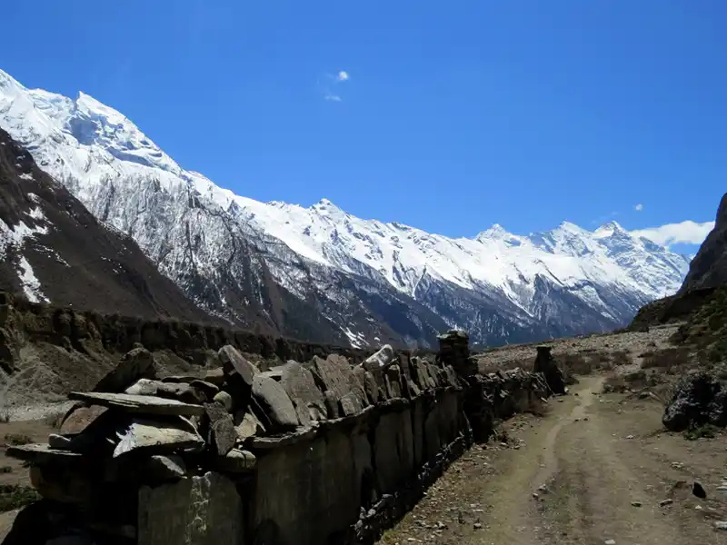
We switch back steeply to the small and impoverished village of Lana, where the women often have their looms set up. After trekking through beautiful pine woods and crossing a small bridge, we will reach Bihi Phedi with its good shop and views of the Kutang Himal. We start to see "mani stones" (prayer inscriptions on rocks), which indicate that we are entering one of the small Tibetan communities that dot the high Himalayas. We have three to four hours of trekking ahead of us, crossing the Budi Gandaki River twice and smaller tributary streams twice. We will remain mostly high, with many ascents and descents as we move through the gorge, enjoying the spectacular views. Finally, we will reach Ghap and set up camp for the night at the house of some friendly villagers.
Today's trek adventure is magnificent. We depart from Ghap and ascend for an hour through a dense, cool forest, crossing the Budi Gandaki River via a wooden bridge and climbing smooth stone steps until we reach Namrung, located at an altitude of 2,540 meters. As we continue to climb, we enter alpine terrain and are rewarded with sweeping mountain views. Tibetans who speak a western Tibetan dialect live in the region of Nubri, which starts with Namrung village. A few hours later, we arrive at Lihi, a village located at 2840 meters above sea level, which houses an ancient gompa and is surrounded by fields of barley guarded by "bear watches.". Our trek continues at a gentle pace, and we soon cross a large stream flowing from the Lidanda Glaciers to reach the picturesque Tibetan village of Sho, located at 3000 meters, where we stop for lunch. After an hour, we reach Lho, greeted with stunning views of Manaslu.
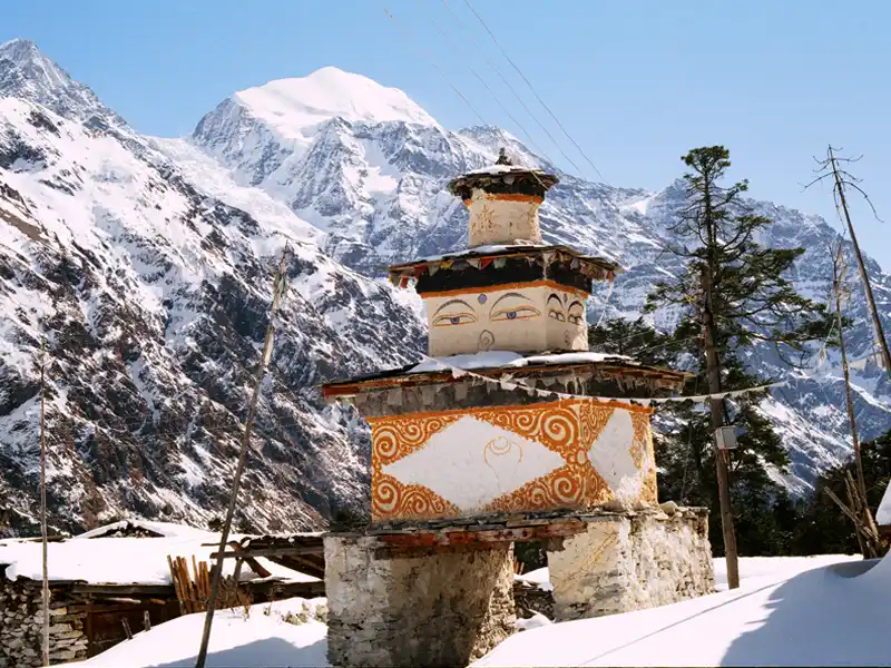
As we walk through the upper reaches of Lho, with the majestic peaks of Manaslu in the distance, we come across the new gompa and then ascend through a light forest next to a small river to reach the idyllic Tibetan settlement of Shayla, where the villagers are often working in the fields. A few more hours of trekking through classic alpine scenery takes us past Tibetan grazing settlements, with the trail to Pung Gyan Gompa branching off to the left. We eventually reach Sama Gaon, passing through checkered fields of barley and potatoes. The people of Sama Gaon are descendants of Tibetans who settled here over 500 years ago. The Tibetan villages in this region of Manaslu are characterized by their distinctive entrance gates (manes), and they maintain active trade with their Tibetan co-religionists over several nearby high passes. On a clear day, you may see village women weaving wool from Tibet into gowns, then trading back to Tibet. Spend the afternoon exploring the old gompa settlement above the town and wandering the streets of the intriguing Samagaon village.
A day dedicated to acclimatization! We trek up to the Ramanan Kharka cirque (4000m) and get close to the glaciers in the stunning Pugyen Valley. When enormous and majestic peaks like Peak 29, Manaslu, and Himal Chuli are in the background, it is an unforgettable experience. We are in the heart of the Great Himalayas, surrounded by imposing mountains that few people ever go into. The trail continues as a beautiful balcony towards the Sama plateau, where we settle in a lodge in the heart of the Tibetan village of Samagaon.
A morning visit to the monastery offers the opportunity to hike towards Birendra Kund glacial lake, located at the foot of the Manaslu glacier. The easy walk to Kermo Manan, with its very long mani wall, leads to an alpine-style valley that gently rises towards a typical Tibetan village. After crossing a small bridge, a short but steep climb brings you to the most beautiful village on the tour: Samdo, with 200 inhabitants. Tibet is easily accessible via Lajing Banjyang, and the people of Samdo, who are of Tibetan origin, still regularly trade with families and grandparents living in Tibet. This superb and welcoming village is an ideal place to discover and rest..
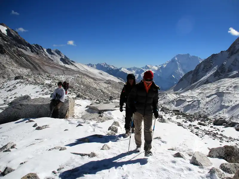
We set out from Samdo and will follow the old trade route toward Tibet. After crossing a bridge, we ascend through the remnants of Larkya Bazaar, a once-thriving trade market. The panoramic views become increasingly stunning as we climb for three hours past glaciers. Our destination is Dharamsala, the high camp for the Larkya La pass. Here, we take a lunch break and savor the breathtaking vistas. The altitude and cold can be intense, so we suggest taking it easy in the afternoon and staying warm. We will have an early dinner to prepare for our journey over the Larkya La Pass tomorrow.
On this chilly but beautiful morning, the sun hits the peaks around us long before we reach the campsite. Leaving the grazing fields of Bhimtang, we cross a boulder-strewn river and head down through open forests of brilliantly blooming rhododendrons, past the Kharka below Bhimtang. We'll stop for lunch at a small tea house before continuing along the rocky riverbed and sliding hillsides to several small, green villages—a sign that we've reached lower altitudes. After a long but scenic day, we eventually reach the large village of Tilje, which has a mix of Manangis (of Tibetan descent) and Chettris (Hindus), resulting in unique architecture and culture and a diverse cuisine including Dal Bhat, buckwheat dhiro, tsampa, and Tibetan salt tea.
A long day awaits us; we will have to get up early!!! We will change our mode of transportation and board jeeps that will take us down the Marsyangdi gorges to the bustling town of Besisahar. From there, we will take a bus that will bring us directly to Kathmandu, crossing beautiful landscapes of terraced rice fields with the snowy peaks of the Annapurnas and Manaslu in the background. We will arrive at the hotel in the evening for our final group dinner.
The cost mentioned on our website for Larkya Peak Climbing 2024 is based on group bookings of 6 to 10 people. However, depending on the group size and your request, we can also organize a private trip for at least two people. For a group booking of 12 or more people, we offer a maximum discount with the availability of a free trip for one person. We understand that many of our clients have specific date preferences and are happy to accommodate them.
- Group Size: The cost of the trip will depend on the size of the group.
- Hotel Accommodation Category and Client's Budget: The cost may also vary based on the accommodation category and budget preference of the client.
- Itinerary Modification: Our trekking itinerary can be modified according to your time and requirements, and the cost will be adjusted accordingly.
- Additional Services: If you require additional services, the cost will be adjusted accordingly based on mutual understanding.
- Trekking Staff: The cost is also affected by the number of Trekking Guides, Assistant Guides, and extra porters required for the trip.
Please don't hesitate to reach out to us with any questions or to book your trip.
| Trip Dates | Trip Cost | Status | Inquiry |
| April 15 - 4 May 2024 | USD USD 2,850.00 Per Person | Available | Inquiry |
| May 7 - 26 May 2024 | USD USD 2,850.00 Per Person | Available | Inquiry |
| Oct 5 - 30 Oct 2024 | USD USD 2,950.00 Per Person | Available | Inquiry |
| Nov 5 - 30 Nov 2024 | USD USD 2,950.00 Per Person | Available | Inquiry |
Cost Includes:
- Airport pick-up and drop services in private transportation before and after the trek.
- 4 Nights 3-Star Accommodation in Kathmandu at twin sharing a room on a BB plan.
- City Cultural Tour in Kathmandu with City Tour Guide and all the entrance and monument fees.
- Transportation: Kathmandu - Barpak and Dharapani - Kathmandu.
- Accommodation: best available guest and camping arrangement during Larkya Peak.
- Completely Lodge and camping trekking with full board i.e. breakfast, lunch, and dinner.
- Experienced English-speaking Climbing Guide, Assistant Guide for of over 6 people and Porters (2:1) including their daily allowance, meal, and accommodation.
- Assisted by Porters with their lodging, food, and their salary, and insurance for all staff.
- Climbing equipment: Ropes (Main & dynamic), Ice screw, Rock piton, snow shovel, and Snow bar, high altitude Tents, High altitude food, and Cooking pot and gas stove.
- Accidental and medical insurance for Nepalese team.
- Trekking Permit Special permit of Manaslu, Manaslu Conservation Area Project (MCAP) and Annapurna Conservation Area Project (ACAP) Entry Permit fee.
- Climbing permit of Larkya Peak
- Necessary documentation, all government taxes, and agency service charge.
Cost Excludes:
- Lunch and dinner in Kathmandu.
- International air ticket.
- Garbage deposit of Larkya Peak which is refundable.
- Summit bonus.
- Beverage and hard drinks and alcohol.
- Nepal entry visa fee and airport tax during the departure.
- Extra supporting staff, laundry, battery charge, and communication expenses.
- Personal expenses like tea, coffee, bar bill, drinking water, beverage, snacks, hot shower, etc.
- Travel and medical insurance, emergency evacuation/natural disaster, or personal reasons.
- In any case of natural calamities, mishaps, or anything beyond our control.
- Tips and gratitude for the members of the trekking or the tour.
Please feel free for any queries.
Q: Where is Larkya peak located?
A: Larkya peak is located in the Manaslu region of Nepal.
Q: What is the altitude of the Larkya peak?
A: The altitude of Larkya peak is 6,249 meters (20,499 feet).
Q: What is the best time to climb Larkya peak?
A: The best time to climb Larkya peak is during the spring (March to May) and autumn (September to November) seasons.
Q: Do I need a permit to climb Larkya peak?
A: Yes, a climbing permit is required to climb Larkya peak, which can be obtained through a registered trekking agency in Nepal.
Q: What is the difficulty level of climbing Larkya peak?
A: Climbing Larkya peak is considered a challenging climb, requiring technical skills and experience in high-altitude mountaineering.
Q: Is it possible to combine a trek to Manaslu with a climb to Larkya peak?
A: Yes, it is possible to combine a trek to the Manaslu region with a climb to Larkya peak, which is a popular itinerary for adventurous trekkers and climbers.
Q: What is the typical duration of a Larkya peak climbing expedition?
A: The typical duration of a Larkya peak climbing expedition is around 18-20 days, including the trek to and from the base camp.
Q: What kind of gear and equipment do I need for Larkya peak climbing?
A: You will need standard mountaineering gear such as crampons, ice axe, harnesses, helmets, ropes, and climbing boots, as well as warm clothing, a sleeping bag, and personal items.
Q: Is it necessary to hire a guide for Larkya peak climbing?
A: It is highly recommended to hire an experienced guide for Larkya peak climbing, as the climb is technically challenging and requires mountaineering skills and experience.
Q: What is the altitude sickness risk during Larkya peak climbing?
A: Altitude sickness is a common risk during Larkya peak climbing due to the high altitude, and climbers are advised to take proper acclimatization breaks and follow a gradual ascent to minimize the risk.
Q: Are there any alternative routes to climb Larkya peak?
A: Yes, there are multiple alternative routes to climb Larkya peak, including the Northern route and the West Face route, which are less crowded and offer a different perspective of the peak.
Q: What is the maximum number of climbers allowed on Larkya peak at a time?
A: The maximum number of climbers allowed on Larkya peak at a time is limited to 15 climbers per expedition.
 Manaslu Larkya Peak Climbing
 Most Popular


